


Introduction
Hantavirus is a group of viruses carried mainly by rodents and can cause serious respiratory and kidney-related diseases in humans. Understanding where hantavirus is found is important for public health awareness and prevention. A hantavirus map helps visualize regions where cases have been reported and where the virus is most likely to exist. This information is useful for researchers, travelers, and people living in rural or rodent-prone areas. In this article, we will explore what a hantavirus map shows, how the virus spreads, and which regions are most affected.
What Is Hantavirus?
Hantavirus belongs to a family of viruses primarily transmitted through rodents such as deer mice, rats, and field mice. Humans usually become infected by inhaling dust contaminated with rodent urine, droppings, or saliva. In rare cases, bites can also transmit the virus.
There are two major types of diseases caused by hantavirus:
Hantavirus Pulmonary Syndrome (HPS), mostly found in the Americas
Hemorrhagic Fever with Renal Syndrome (HFRS), commonly found in Europe and Asia
Both conditions are serious and can become life-threatening without early medical attention.
Understanding the Hantavirus Map
A hantavirus map is a visual representation showing regions where hantavirus cases have been reported or where rodent carriers are commonly found. These maps are created using epidemiological data, wildlife studies, and confirmed human cases.
Such maps help identify:
High-risk areas with frequent outbreaks
Regions where rodent populations carry the virus
Seasonal patterns of infection
Rural and wilderness zones with higher exposure risk
These maps are not static. They change over time based on environmental conditions, climate, and rodent population movements.
Regions Where Hantavirus Is Common
Hantavirus is found worldwide, but its distribution varies depending on the type of virus and rodent species.
North and South America
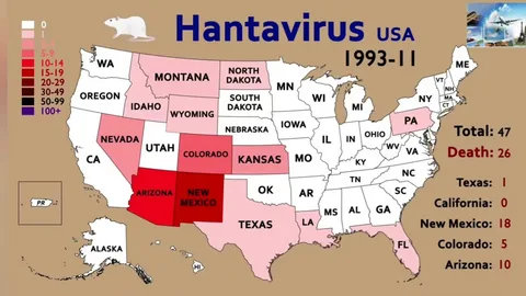
In the Americas, hantavirus cases are more commonly associated with Hantavirus Pulmonary Syndrome. Countries like the United States, Canada, Argentina, Chile, and Brazil have reported cases. In the United States, rural and western states with dry environments are more frequently affected.
Europe
In Europe, hantavirus infections usually result in Hemorrhagic Fever with Renal Syndrome. Countries like Germany, France, Sweden, Finland, and parts of Eastern Europe report cases, especially in forested or agricultural areas.
Europe
Asia has the highest number of HFRS cases globally. China, South Korea, Russia, and parts of Japan are considered high-risk regions. Rural farming communities are more exposed due to close contact with rodents.
Africa and Other Regions
Hantavirus presence in Africa is less documented but still possible. Research continues to identify rodent species that may carry the virus in different environments.
How Hantavirus Maps Help Public Health
Hantavirus maps are important tools for governments and health organizations. They help in:
Tracking outbreaks and preventing spread
Planning awareness campaigns in high-risk areas
Guiding doctors for early diagnosis in suspected regions
Supporting environmental control programs to reduce rodent populations
These maps also help scientists study the relationship between climate change and virus spread. Warmer temperatures and changing ecosystems can affect rodent behavior, increasing human exposure risks.
Risk Factors Shown on the Map
A hantavirus map does not only show locations but also highlights risk factors such as:
Rural housing near forests or fields
Poor sanitation and rodent infestation
Seasonal farming activities
Camping or hiking in wild areas
Understanding these factors helps people take preventive measures when living in or visiting affected regions.
Prevention and Safety Tips
Even in high-risk areas shown on hantavirus maps, infection can be prevented. Important safety measures include:
Avoiding contact with rodents and their waste
Sealing homes to prevent rodent entry
Cleaning rodent-infested areas with proper disinfectants
Wearing masks and gloves in dusty or abandoned spaces
Storing food in sealed containers
These precautions significantly reduce the risk of infection.
Conclusion
A hantavirus map is a valuable resource for understanding where this virus exists and how it spreads. It highlights high-risk regions across the Americas, Europe, and Asia, helping people stay informed and cautious. While hantavirus infections are rare, they can be severe, making awareness and prevention essential. By studying these maps and following safety measures, communities can reduce exposure and protect public health effectively.


Comments are closed